By Ashley Peterson
I guess you could say my highpoints journey started on Feb. 1 when I applied for the Mt. Whitney lottery. Mt. Whitney, or Fishermen’s Peak as it was originally named when it was first climbed by a group of fishermen in 1883, is located in the Sierra Nevada in California and stands at 14,508’(ish), and is the highest peak in the lower 48 states.
Obviously, the actual height is exact and not approximate, but there always seems to be some debate to exactly how tall a peak actually is. The height of a peak is calculated by measuring the distance between two points on the ground and then measuring the angles between the top of the mountain and each point, so each estimate may differ slightly. Regardless of the actual height though, I’d been wanting to go so badly; I had the calendar reminder saved for months.
On Feb. 1, the first day you can apply for the permit, I eagerly submitted and crossed my fingers. I was anxious but hopeful that I would win the lottery. You don’t always need a permit for Whitney, only if you want to climb it between May and October, which I did. I applied for dates in May, just after the first year of the Masters of Environmental Management (MEM) program. May is a little early; if you want to hike with no snow, go later in the summer, but I was hoping for snow!
Much to my delight, in March I received an email telling me that I got an overnight permit for me and three of my buds for May 17. The 2019 Whitney stats show that there were 16,842 applications and 34% of those received a date of their choice. So, the odds are fair, but if you want to go, definitely apply on the first day! I think it also helped that I applied for dates in May, whereas most people want to go in the heart of summer.
I immediately asked my friend Patrick from Portland, and my friend Max Sawyer that is in my MEM cohort. He brought a friend along, and that made four. We trained and prepped, unsure what the conditions would be like when we arrived. The whole hike is about 21 miles, with ~ 6,646 feet of elevation gain.
Upon arrival at the trailhead, we hiked the 6 miles to trail camp. On the way up, we were asking everyone if they had summited, many said no. The weather that day had not been ideal with hail and strong winds, and as most people only apply for a one or two-day permit, they had no choice but to descend. We were slightly concerned but anticipated that the weather the next day would be much better, so we crossed our fingers and hoped that would be the case.

When we arrived at trail camp, our home for the night, there was water and at least 10 open campsites. Right as we were getting to camp it started hailing and snowing like crazy, immediately turning the ground white, so we put up our backpacking tents quickly and jumped in. When the hail finally stopped, we got out, refilled water and calories, and stared at the gigantic peak above us. Giddy as can be for the adventure that awaited us in the morning, we went to bed early, anticipating an alpine start.
Patrick’s headlamp died before we left camp in the morning. Luckily, I had a spare, and with crisis averted, I ate something, and we took off, hours before daylight, around 2 a.m.. We had helmets, poles, ice axes, crampons, and micro-spikes on us or in our packs, unsure of what to expect but wanting to be prepared.
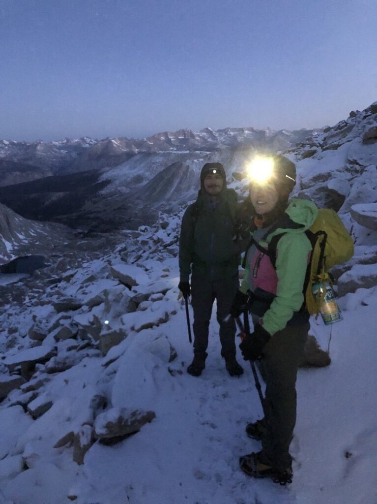
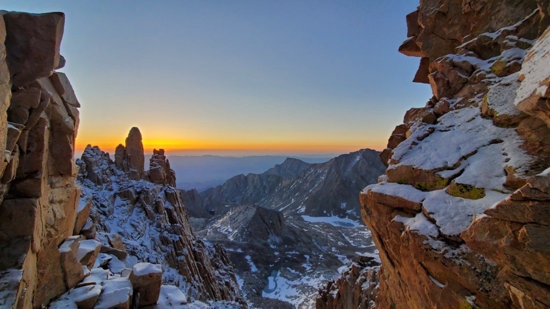
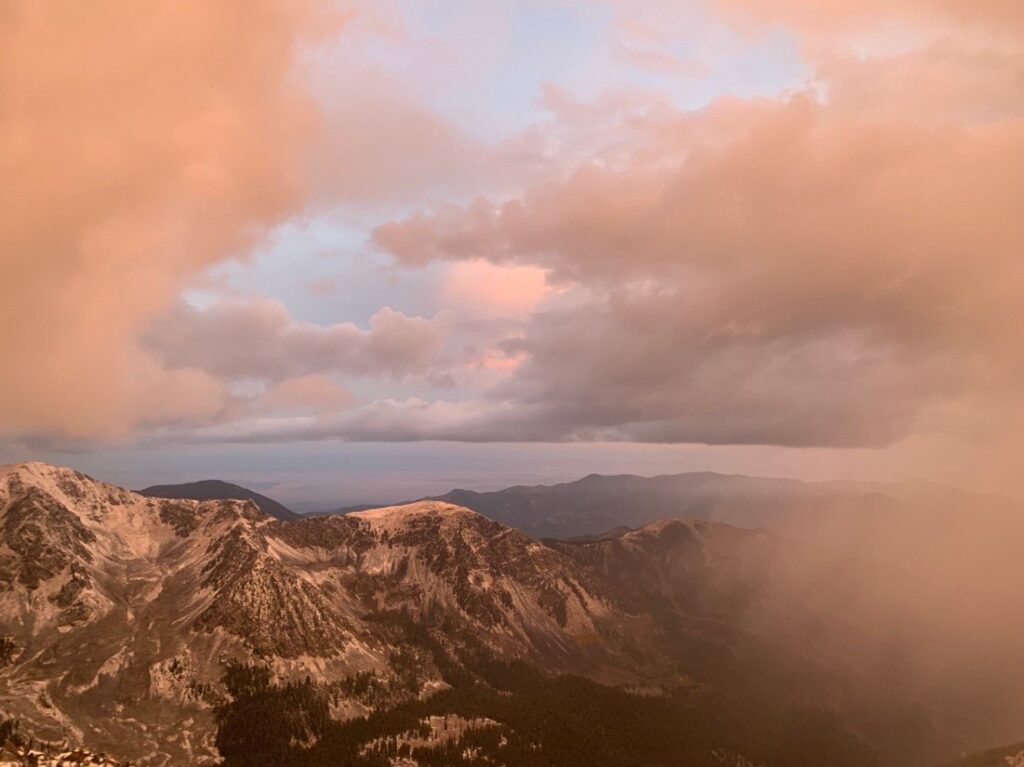
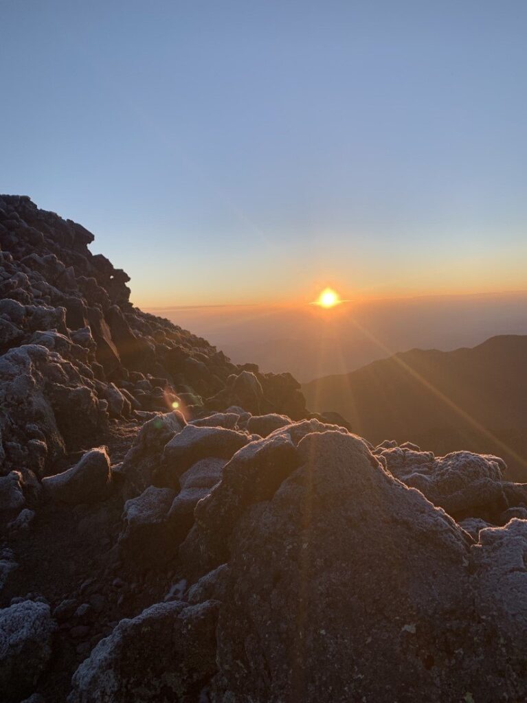
The hike up the infamous switchbacks was dry for quite a while, but eventually turned to snow so we threw on micro-spikes. Finally, up on the ridge, we were greeted by one of the most glorious sunrises I have witnessed to date. And THIS is why I wake up at oh-early-thirty to start hiking.

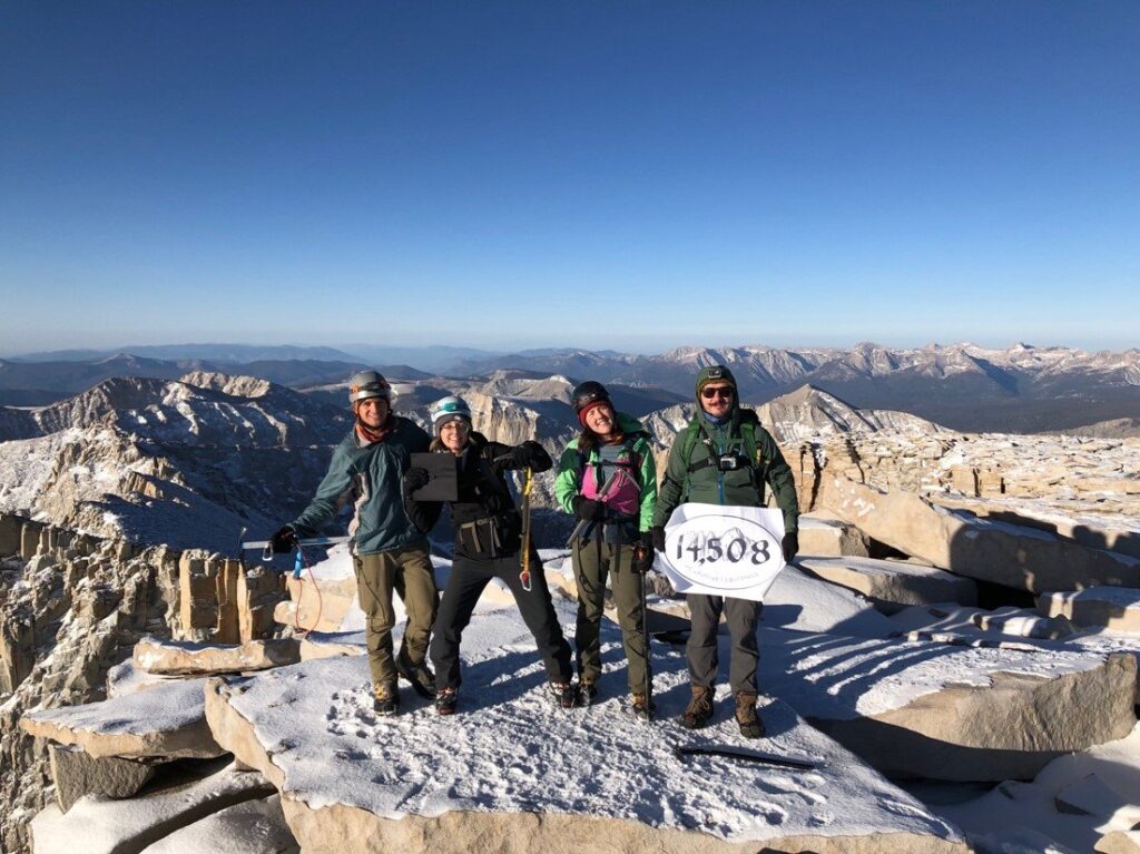
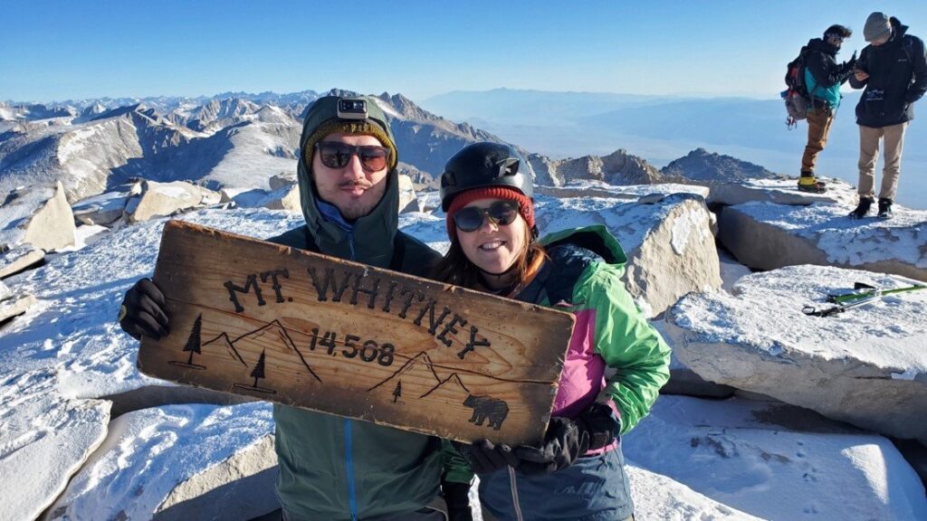
By 7:30 a.m., we had reached summit. It didn’t end up taking nearly as long as we had thought. Giddy as can be, on top of the country. The conditions were cold, but we were so excited about where we were that we hardly noticed. Sunny and clear, not a cloud in the sky, better than we could have hoped.
Someone called home and told the rest they had service, so all of us started making phone calls home. My call went something like this, “Hey dad, we just made it to the top of the United States and I’m so excited!! The conditions are amazing and it’s so sunny and the hike has been a blast so far!! That’s all for now pops, toodaloo!”
We were all feeling fantastic, so we took our photos, howled and shouted, breathed in that cool mountain air. The deep breaths, along with the views, are some of my favorite things about summits. The air feels like a cool drink of water for my spirit; it revitalizes me with every inhale, and I exhale gratitude across the surrounding mountain tops.
The downclimb was effortless, not very steep but there was some slush on the trail due to the beautifully sunny day. We were all amazed by what we had just accomplished. We went to a restaurant and got burgers (veggie for Bella and myself) which we scarfed down. Back at the camp, we sat in camp chairs, drank wine, and talked in hushed but still excited tones, while we stared up at the mountain that we had just climbed. What a day! The satisfaction that comes with achievement was felt by each of us so fully and unlike the somewhat restless sleep of the night before, we slept soundly in utter content.
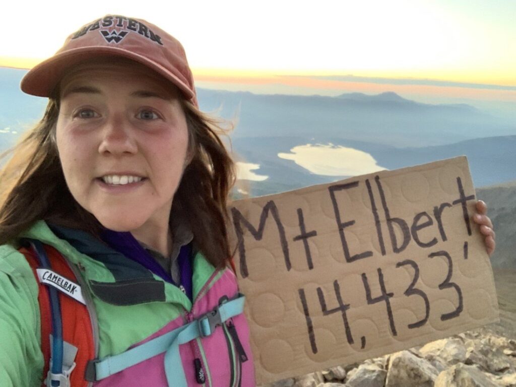
This adventure sparked my interest in state highpoints, but I was hiking Colorado 14ers much of the summer and it would be several months before I hiked my next highpoint. I had always been interested in Elbert (14,439’), but the main route up the northeast ridge is Class 1 (a straightforward, nontechnical hike) and I didn’t want to deal with the throngs of people, so I planned to summit after the summer when crowds wouldn’t be an issue.
However, on the last weekend in August, my friend Brad and I hiked the 14er La Plata, over by Twin Lakes, and when we had finished and gone to Twin Lakes, I saw on Google Maps that there was a trailhead for the southeast ridge of Elbert. I had never heard about it, so I looked it up on 14ers.com and found that it was a harder trail, Class 2 with more elevation gain, which is exactly what I needed to hear.
From the Black Cloud trailhead, I hiked Mt. Elbert on Aug. 29. At the trailhead the evening before, I started asking everyone coming down how the hike was and how long it had taken. All the responses I got were daunting. Some said 12, some said 13 hours, and they all said HARD. I had to work in the evening after the hike so this got me a little nervous about making it back in time.
I got up early and set off. Hiking in the dark by headlamp is one of my favorite things to do. Every rustle of leaves in the bushes is daunting and makes my heart and pace pick up a little; the stars are amazing when the sky is clear and I make frequent stops to turn off my headlamp and just look up into a sky full of shimmering stars, and the world is nearly silent and at peace. I made it to summit for sunrise and had the peak to myself. I love these quiet moments, waiting for the sun to brighten my world.
Round trip, the hike took me about 6 hours, and I tacked on a 13er (Cosgriff peak) that was close by. I made it to work in plenty of time! This was a fun one. If you want to get Colorado’s highpoint, this is the way I would recommend doing it. Of course, if you do not mind throngs of people and want an easier hike, the northeast ridge is always still an option.
Having a little break from school, I decided to hike some highpoints in October. First on my list, Wheeler Peak (13,159’), New Mexico’s highpoint. I guest-lectured an undergraduate class on Sept. 28 and left Gunni soon after. I hiked Wheeler on Sept. 30; it is only a little over 4 hours from Gunnison.
I car camped as usual and woke up early to start the hike. There was a chance of snow or rain, which I soon got to experience because the snow/hail/graupel started about 20 minutes into the hike. Graupel is basically white stuff falling from the sky but you’re not quite sure what it is. Mirriam-Webster defines it as “granular snow pellets —called also soft hail”.
I forgot how much I had missed snow and its relatives! The hike was a little over 8.5 miles and just short of 3,000’ of elevation gain. It was frigid and oh-so-windy once I reached the ridge; the sky was starting to lighten but there was so much fog that it was barely perceptible.
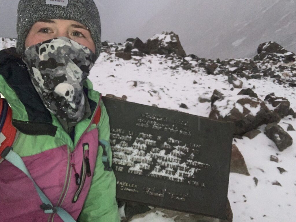
I wasn’t at the summit for long; there wasn’t much to see up there. I started descending, and the sky so graciously decided to open up and show me blue for all of 12 seconds.
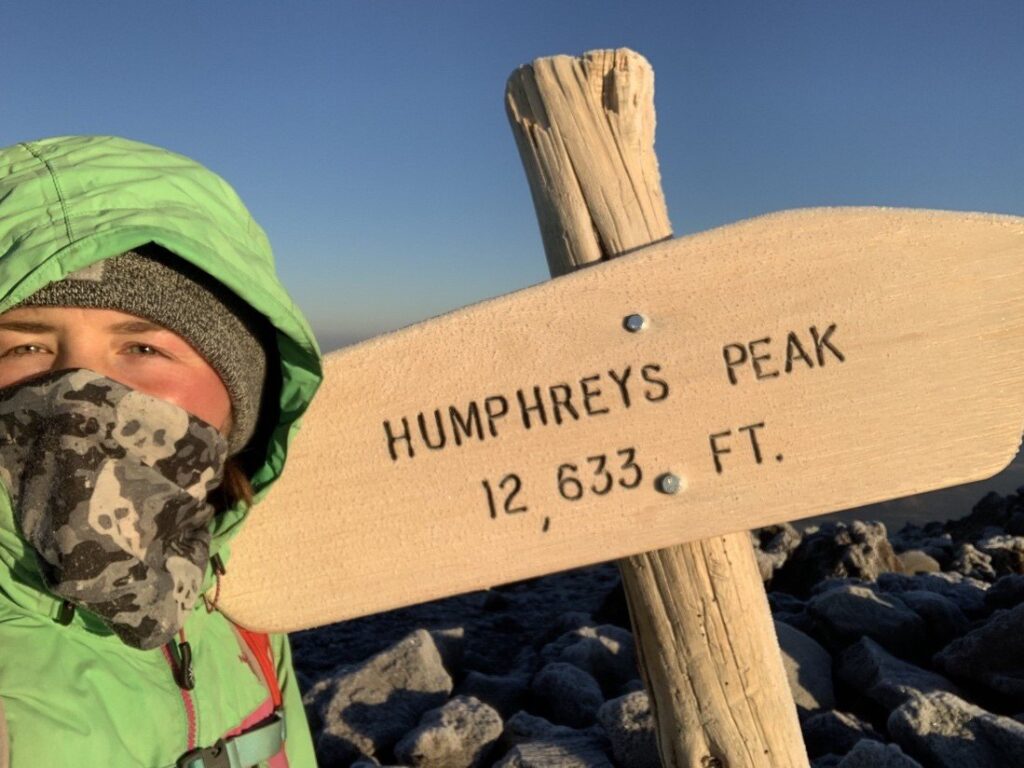
Rather cold, but a successful and fun hike! Honestly, because of the proximity to Gunni, I think everyone should do this hike! Super wonderful. It took me less than 3.5 hours. And then I was off to Arizona for Humphreys Peak (12,633’).
After an ~8-hour drive, I made it to my next destination. This hike is a bit longer, Strava clocked me at 10.2 miles, 3,359’ gain, and 4.5 hours. I had no idea it was going to be so cold though, that’s my only complaint; it was FRIGID up there on that ridge. But a great time nevertheless.
The Summit was COLD. My Camelbak was frozen, so no water for me. I had the summit to myself again, and this time I had a view!
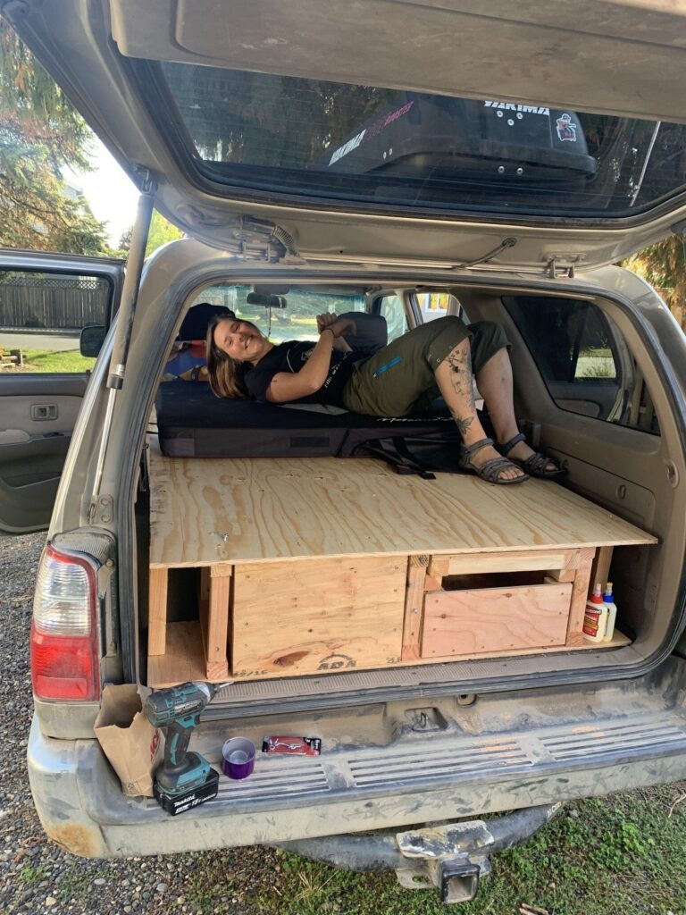
After Humphreys, I went home to Oregon for a week. The Hobo Rocket (my 4Runner), named after the Barns Courtney song by the same name, needed a little work before it would be ready to tour the nation once more. We went home, got new wheels and tires, a brushguard and drawers and set off again, heading east for North Dakota.
Thank you for reading part 1 of my highpoints journey, and stay tuned for part 2!
So cool to hear about your amazing adventures… can’t wait to read more …
Ashley, You’re amazing. I loved reading this and seeing the pictures. Look forward to hearing more.